Tides
Ocean tides are periodic rises and falls in the level of the sea, and are formed by the gravitational attraction of the Moon and Sun on the water in the ocean. Although the Moon is much smaller than the Sun, it has a greater gravitational attraction for the Earth because the Moon is much closer to Earth. This causes the oceans to bulge out in the direction of the Moon.
Equilibrium Theory of Tides
Two theories help explain tides. The equilibrium theory of tides uses the universal laws of physics, as applied to a water-covered Earth. The dynamic theory of tides studies tides as they occur in the real world, modified by landmasses, geometry of the ocean basins , and Earth's rotation.
The equilibrium tidal theory begins with a hypothetical, water-covered planet and its satellite moon orbiting the Sun. The Moon is held in orbit with Earth by Earth's gravitational force. There is also a centrifugal force pulling the Moon away from Earth and trying to send it spinning out into space.
Earth and the Moon rotate around the common center of mass of the Earth-Moon system; this system is held in orbit by the Sun's gravitational attraction while centrifugal force pulls the center of the mass away from the Sun. Both forces, gravitational and centrifugal, must reach and maintain equilibrium to hold the Earth-Moon system in orbit.
In the Earth-Moon-Sun system, the mass of the Sun is greatest, but its extreme distance renders its gravitational pull nominal. The tidegenerating force of the Moon and Sun vary as the inverse cube of their distances from Earth. The mass of the Moon is very small by comparison, but it is considerably closer, and therefore has a greater attractive effect on water particles than does the Sun.
Lunar Tides.
Water responds to the Moon's gravitational force by flowing toward it, making a bulge on the surface of the ocean. On the side of Earth facing the Moon, gravitational force is applied to water particles toward the Moon. This force produces a lunar bulge in the layer of ocean water. At the same time, the centrifugal force of the Earth-Moon system acting on the water particles at Earth's surface opposite the Moon creates a second bulge.
Two lunar bulges on opposite sides of Earth are created on a planet covered by a uniformly deep ocean. The bulges represent the crests of the two tidal waves (high tide), directly opposite each other, and the low water areas are the two troughs (low tide). The equilibrium tidal theory predicts tides that are semidiurnal, which means two high and two low tides each day.
Earth and the Moon are moving in the same direction along their orbit with the Sun. Earth rotates once during a 24-hour period but Earth must turn an extra 12 degrees, or 50 minutes, for the Moon to be directly over the same place as the day before because of the Moon's rotation. Therefore a tidal day is not 24 hours long but rather 24 hours and 50 minutes, and the tidal period between high tides is 12 hours and 25 minutes. This explains why tides arrive at the same location about an hour later each day. The wavelength of the two tidal waves is one-half the circumference of Earth.
Solar Tides.
The Moon plays the greatest role in tide-building, but the Sun also produces its own tidal bulge. Though of much greater mass, the Sun's distance reduces its tide-raising force to only 46 percent that of the Moon, and the tide period is 24 hours, not 24 hours and 50 minutes. The lunar
![Tidal maxima are greatest during spring tides (part [a]), which arise during each phase of a new moon or a full moon when Earth, Sun, and Moon are aligned. Conversely, twice each month when the Sun and Moon are at right angles to the Earth and hence are opposing one another, the tidal ranges are slighter and are called neap tides (part [b]).](../images/wsci_04_img0544.jpg)
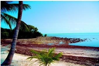
On land, the tides appear to flood in during a high tide, earning the name flood tide, and then flow back out to sea as an ebb tide. Earth's rotation is responsible for carrying the landmasses into and out of the tidal bulges. It is as if Earth were constantly rotating inside a fluid envelope of ocean whose tidal bulges are supported by both the Moon and Sun.
Spring and Neap Tides
During the 29.5 days it takes for the Moon to orbit Earth, the Sun, Earth, and Moon move in and out of alignment with each other. During the period of the new Moon, the Sun and Moon are lined up on the same side of Earth so that the high tides that are produced independently of each other coincide. The tide level is the result of adding the two waveforms together, producing tides of maximum range between high and low water. These are called spring tides (see part [a] above).
One week later, the Moon is in its first quarter and moves about 12 degrees per day, until it is at a 90-degree angle to the solar bulge (see part [b]). The crests of the lunar bulge will now coincide with the troughs, produced by the Sun, and the same is true of the Sun's crests and Moon's troughs. These tides are called neap tides. Tidal effects of the Moon and Sun tend to cancel each other out, and the range between high and low tide is small.
At the end of another week, the Moon phase is full and the Sun, Earth, and Moon are again in alignment; however, they are on opposite sides of Earth. This again produces spring tides with crests that coincide, but generally slightly less than during the new Moon phase. These are followed again by neap tides, 1 week later, and the 4-week cycle continues with spring tides and neap tides every other week.
Tides are an extreme example of shallow-water waves. The extremely long wavelength of the tidal wave is 20,000 kilometers (12,400 miles) compared to an average ocean depth of 4 kilometer. A shallow wave is one traveling in water depths less than 1/20 of its wavelength; because 4/20,000 is considerable smaller than 1/20, tides are shallow waves. The tidal wave is a progressive wave as it moves through the ocean; however, it is far different than wind-driven, progressive waves. Tidal bulges move as forced waves, with their velocity determined by ocean depth.
Dynamic Theory of Tides
Fortunately for land-dwelling creatures, Earth is not the watery world depicted in the equilibrium tidal theory. To study ocean tides, which are modified by landmasses, the geometry of ocean basins and Earth's rotation and declination, scientists developed the dynamic theory of tides.
Tide Patterns.
Tides behave differently in various parts of the world. Some coastal areas experience a regular pattern of one high tide and one low tide each day, known as a diurnal tide. This pattern is common in shallow inland seas, such the Gulf of Mexico and along the coast of Southeast Asia, and exhibits a tidal period of 24 hours, 50 minutes.
In many areas, including the Atlantic Coast of the United States, there is a high tide to low tide sequence repeated twice a day, termed a semidiurnal tide. These tides usually reach about the same level at high and low tides each day, and have a tidal period of 12 hours, 25 minutes.
The third pattern of tide has two high and two low tides per day, but the tides reach different high and low levels during each daily rhythm. Called a semidiurnal mixed tide, it results from combining a semidiurnal and diurnal tide. Mixed tides commonly have a tidal period of 12 hours, 25 minutes, but may also exhibit diurnal periods. This is the most common tide pattern throughout the world, and is found along the Pacific Coast of the United States.
Declination Tides.
If Earth and the Moon are aligned so that the Moon is north or south of Earth's equator, one tidal bulge will be in the Northern Hemisphere and one in the Southern Hemisphere. A point in the middle latitudes passes through only one crest and one trough during each tidal day. This type of diurnal tide is called a declination tide, because the Moon is said to have declination when it stands above or below the equator and not perpendicular to it.
The Sun also influences declination tides when it is aligned over 23.5 degrees north or south latitude at the summer and winter solstice. The variation causes the bulge created by the Sun to oscillate north to south, making a more diurnal Sun tide during the winter and summer months. The Moon's declination is at 28.5 degrees north to south latitude, and because
Also, the Moon does not move around Earth in a perfectly circular orbit and Earth does not circle the Sun at a constant distance. In the Northern Hemisphere, Earth is closer to the Sun in the winter months, so the solar tides play a greater role as a tide producer in the winter than summer.
Coriolis Effect
Another influence on waves, tides, and ocean currents is the Coriolis effect. Earth is constantly rotating towards the east and the speed of Earth's rotation varies greatly at different latitudes. It travels fastest on the equator and slows in speed at the farther latitudes. Because of this, the Coriolis effect forces moving objects on Earth to follow curved paths. In the Northern Hemisphere, an object will follow a path to the right of its intended course, and in the Southern Hemisphere, an object will follow a path to the left of its intended course.
The Coriolis effect acts on all objects moving freely over the surface of Earth, and has a dramatic effect on atmospheric circulation and ocean currents and tides. Most ocean basins in the Northern Hemisphere will exhibit a circular current flow, known as a gyre, that rotates in a clockwise direction. The opposite is true in the Southern Hemisphere where ocean gyres predominately rotate counterclockwise.
Landforms and Tides
There are over 150 factors that can affect tide behavior along any given coast or ocean basin. The greatest influences on the tides are the Coriolis effect, landforms, and ocean depth.
An idealized tidal wave would move across Earth at 1,600 kilometers per hour (1,000 miles per hour) at the equator. Because tides are an extreme example of a shallow-water wave, friction with the ocean floor slows tides to a speed of about 700 kilometers per hour (435 miles per hour). Continents further restrict tide movement. The tidal waves cannot keep up
There are about twelve cells worldwide with five in the Pacific Ocean. In the middle of each cell is a node located near the center of an ocean basin, termed an amphidromic point, a no-tide point in the ocean around which the tidal crests and troughs rotate through each tidal cycle. Owing to the shape and location of landmasses surrounding the ocean basins, the tidal crests and troughs cancel each at these points.
The tidal wave crests sweep around each amphidromic point, like spokes on a bicycle wheel. Because a large volume of water moves with the tidal wave, it is easily influenced by the Coriolis effect. The tidal waves move counterclockwise around the amphidromic points in the Northern Hemisphere and clockwise around amphidromic points in the Southern Hemisphere. The farther from the amphidromic point, the higher the tide level becomes. The farthest point away from the central node is the antinode, where maximum vertical movement between crest and trough is found.
Tides in Bays and Estuaries.
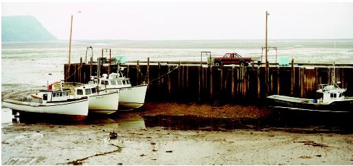
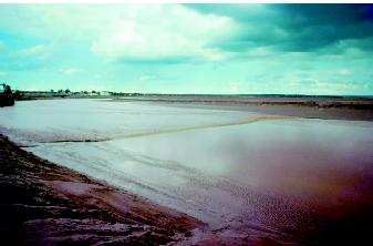
As the tides rise along the coastline, they enter the bays, harbors, and estuaries and travel inland as far as elevation will allow. This point is termed the head of tidewater. The time of high tide becomes progressively delayed the farther inland it must travel. As tides enter coastal waters, they are affected by reflection just as waves are. In certain circumstances, constructive interference can result in tides with extreme highs and lows.
A classic example of constructive interference is the Bay of Fundy in Nova Scotia, Canada. The bay opens into the Atlantic Ocean and extends inland in two narrow arms for 258 kilometers (160 miles), curving to the north. Due to its length, the time it requires for the tide to reach the head of tidewater is nearly equal to that of the tidal period. This forces a buildup of tidal water in the northern end of the bay.
Coupled with the extra energy of the Coriolis effect (the bay bends to the right), during maximum spring tides, the Bay of Fundy receives the highest tidal range in the world at 17 meters (56 feet). This type of constructive interference can also occur as tides flow into an estuary against an outflowing current. Standing waves, termed tidal bores, will form and progress upstream at heights of several feet.
Because of the effects of friction, as the tidal wave approaches shallow water, a reversing current forms where the water flows with force, in and out of restrictive passages. Reversing current is of concern to navigators due to their high velocities, reaching 44 kilometers (28 miles) per hour between the coastal islands of British Columbia.
Tide Prediction and Tide Tables
In the uniform tidal system (semi and diurnal), the greatest height to which the tide rises on any day is known as high water and the lowest point is low water. In a mixed system, it refers to higher high and lower high water and higher low and lower low waters. Tidal observations made over a period of time are used to calculate the average or mean tide levels.
Because the depth of coastal waters is important for navigation, an average low-water reference is established. Water depths are measured from this level and recorded on navigational charts. The low water reference point is usually established at the mean low-water level, and a zero reference or tidal datum is established at this point. In mixed tidal areas, mean low water is used as the tidal datum. Sometimes, the low-tide level may fall below the mean value used as the tidal datum, producing a minus tide.
Tidal predictions are based on recorded high measurement from past records, and then are used to predict the future. But because of all the complex combination of possibilities, it is difficult to predict Earth's tides from knowledge of physical processes and the historical record. Yet with a combination of actual local measurements with known astronomical data, scientists can derive very accurate tide predictions.
Tide gage recording stations are installed at numerous coastal sites, which track the rise and fall of ocean waters. * A minimum of 19 years of records is needed to allow for the long 18.6-year period of declination of the Moon. Tide tables are published annually by the National Oceanic and Atmospheric Administration and give the dates, times, phases of the Moon, and ocean and water levels for high and low tide at numerous locations along the coast and inland on some bays and estuaries to the head of tidewater.
SEE ALSO Beaches ; Coastal Ocean ; Energy from the Ocean ; Estuaries ; Ocean Currents ; Waves.
Ron Crouse
Bibliography
Garrison, Tom. Oceanography, An Invitation to Marine Science. New York: WadsworthPublishing Company, 1996.
Prager, Ellen J., with Sylvia A Earle. The Oceans. New York: McGraw-Hill, 2000.
Summerhayes, C. P., and S. A. Thorpe. Oceanography, An Illustrated Guide. New York:John Wiley & Sons, 1996.
Thurman, Harold V., and Alan P. Trujillo. Essentials of Oceanography. Upper SaddleRiver, NJ: Prentice Hall, 1999.
Internet Resources
Tides Online. National Oceanic and Atmospheric Administration. <http://tidesonline.nos.noaa.gov>
* See "Sea Level" for a photograph of a tide gage station.